CHATTOOGA NATIONAL WILD AND SCENIC RIVER, CHATTOOGA RIVER – HIGHWAY 28 TO EARL’S FORD
LOCATION: Northwestern South Carolina
TRIP STARTS: Highway 28
TRIP ENDS: Earls Ford
TOTAL DISTANCE: 7.0 Miles
TRIP TYPE: One Way, Shuttle Hike
TRIP DIFFICULTY: Moderate
ROUTER USED: Chattooga River
TRAIL TRAFFIC: Light to Moderate
TRIP TYPE: Overnight Trip
MORE INFORMATION:
Sumter National Forest
Andrew Pickens Ranger District
112 Andrew Pickens Circle
Mountain Rest, South Carolina 29664
(864) 638-9568
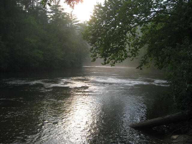
HIGHLIGHTS: The Chattooga River begins in the mountains of North Carolina as small rivulets, nourished by springs and abundant rainfall, high on the slopes of the Appalachian Mountains. The water drops a half mile in elevation over fifty miles as it winds its way to Lake Tugaloo where the river ends between South Carolina and Georgia. The Chattooga is one of the few remaining free-flowing streams in the Southeast, and the setting is primitive with dense forests and undeveloped shorelines on most of its route. On May 10, 1974, Congress designated the Chattooga a Wild and Scenic River – a honor reserved for rivers with outstanding scenery, recreation, wildlife, geologic, and cultural values.
This is a kayaking trip that runs a seven mile section of the river starting at Highway 28 and ending at Earl’s Ford near Westminster, South Carolina. The river in this section (section two) has a few class two rapids and a single class three at Big Shoals which is easily forded during periods of lower water. The trip can be done in four to six hours as either a day trip or as an overnight float trip with campsites scattered along the river – particularly after Big Shoals.

Speak Your Mind